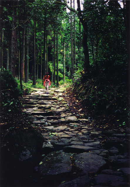
A slope connecting Wakimoto, Aira-shi and Muregaoka, Kagoshima-shi. The mountain area where this slope locates used to be a border among Satsuma-no-kuni (former Yoshida-cho) and Osumi-no-kuni (former Aira-cho side). It is said that military commanders such as Takahisa Shimazu and Yoshihiro set up their camps on this slope.In Edo period (1603-1868), Shirakane Slope became known as one of the tough spots on Okuchi-suji route, a major route of Satusma Domain connecting Kagoshima Castle and Kumamoto. The remaining section of 2.7 km length has an altitude difference of 300 m and over. "Nanamagari" is a section with a stone pavement at a steep point near the midpoint which tells the ancient atmosphere.Stones are said to be carried from Tsuzurano in Terashi.